
Readings and Visual Media
Language, Ethnicity, and Religion Slides
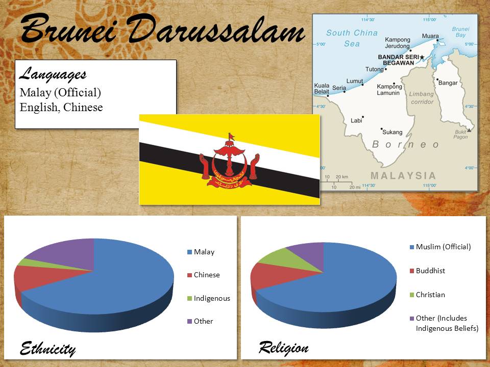
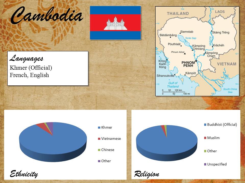
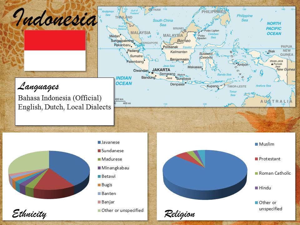
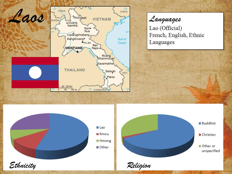
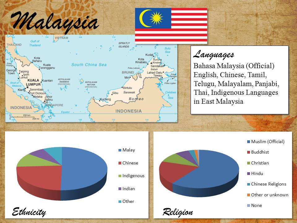
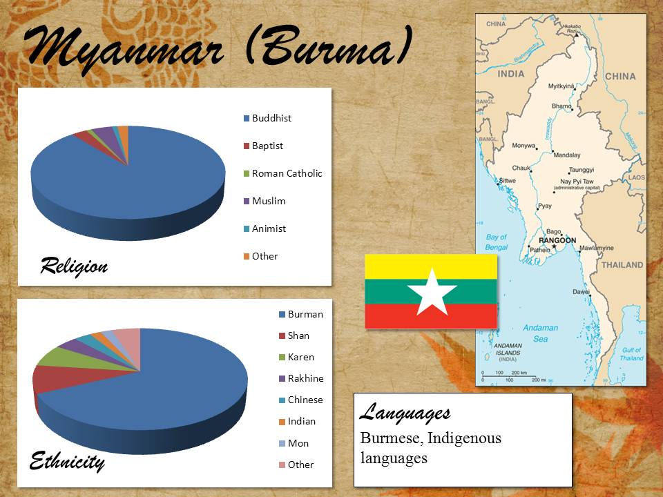
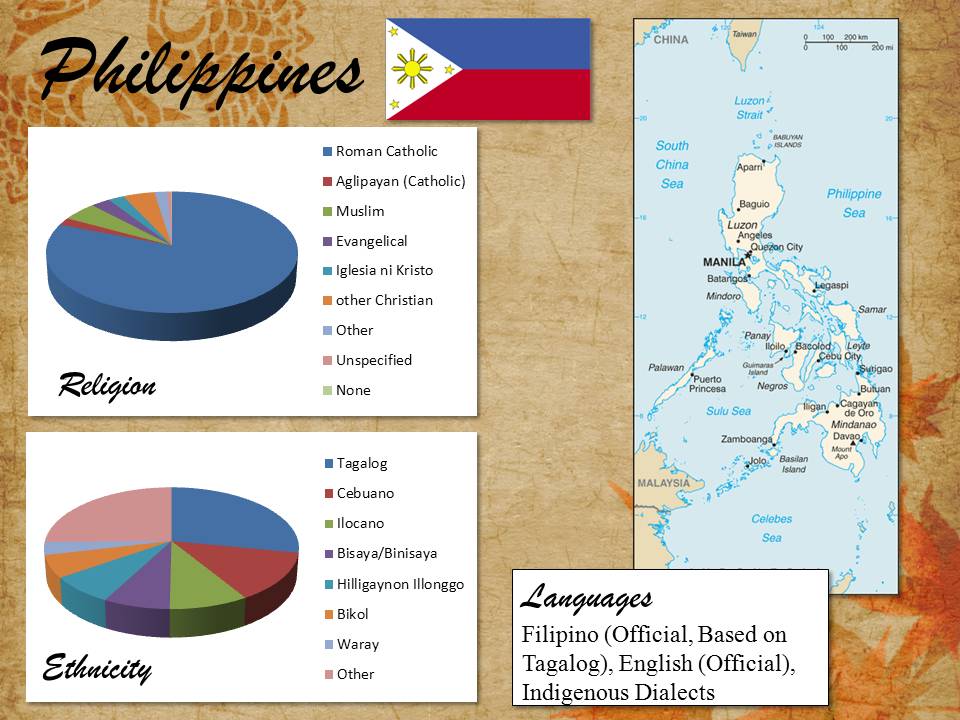
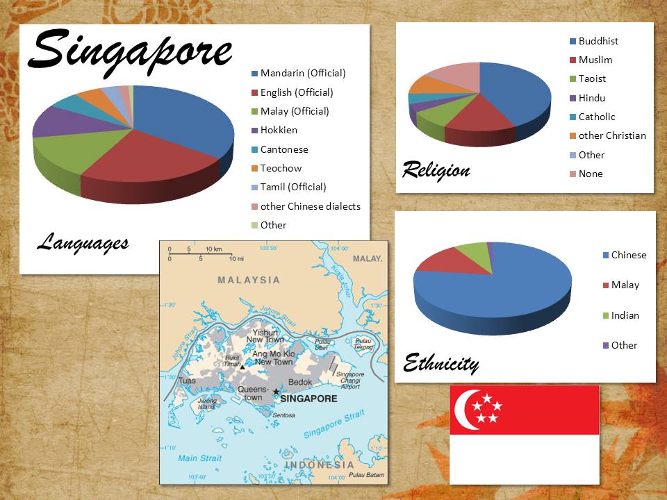
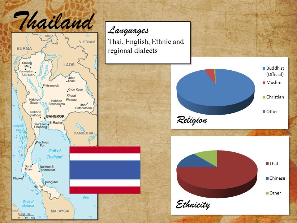
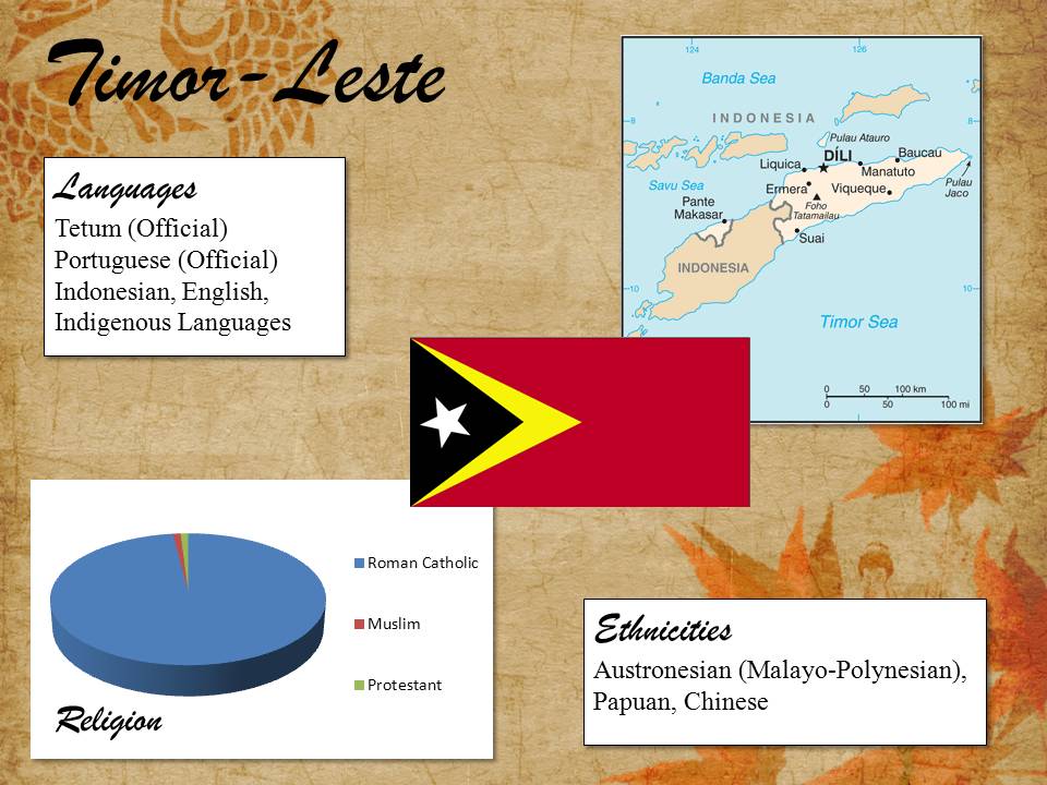
Graphics were created using data and images from the CIA World Factbook for each of the listed countries.
Click on each link to open and download the graphic.
Brunei
Cambodia
Indonesia
Laos
Malaysia
Myanmar
Philippines
Singapore
Thailand
Timor
Vietnam
Language, Ethnicity Religion Summary Table
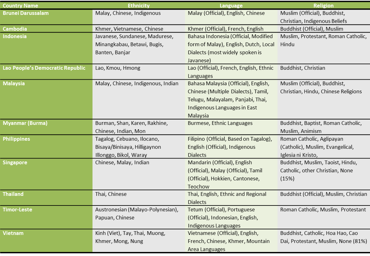
This summary table contains the same information as the graphics above and is provided here in a table to facilitate comparison and analysis.
Download the table here.
Center for Southeast Asian Studies
We provide resources and support on Southeast Asian studies to K-16 educators and students, businesses, community groups, organizations and individuals throughout the northern Illinois region and beyond.
https://www.niu.edu/cseas/resources/educators.shtml
SEAsite Interactive Learning Resources for SE Asian Languages, Literatures and Cultures
Land of Shadows
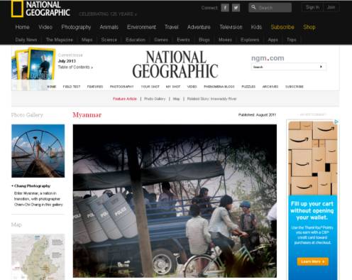
In August, 2011 National Geographic published a feature article on Myanmar and its emergence from long isolation. The online materials include the full-length text of the article, a photo gallery and a map.
http://ngm.nationalgeographic.com/2011/08/burma/chang-photography
American Geographical Society Digital Map Collection
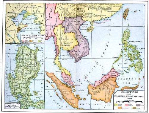
A small collection of maps varying in age from 1696 to 1947. This French map from 1884 is particularly interesting, as itshows (in color) the various territories controlled by Spain, the Netherlands, England and France, as well as some of the different names used by the French for territories in this region.
http://collections.lib.uwm.edu/cdm/search/collection/agdm/collection/agdm/
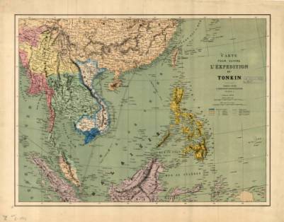
Historical Maps of Southeast Asia
Florida’s Educational Technology Clearinghouse, University of South Florida offers
fourteen historical maps of Southeast Asia dating from 1805 to 1922. The collection shows the dwindling borders of Thailand as France and England compete for territory in the area.
http://etc.usf.edu/maps/galleries/Asia/regional/SoutheastAsia.php
Islam in Southeast Asia
This website, created by the Asia Society, contains numerous materials on the spread of Islam into Southeast Asia. There is a timeline, a collection of images and maps, and numerous lesson plans for teachers to use.
http://sites.asiasociety.org/education/islam_in_seasia/index.htm
Perry-Castaneda Library Map Collection: Asia Maps
An extensive collection of maps from the University of Texas at Austin that includes historical, thematic, topographic, and general reference maps from all over Asia.
South-East Asia’s Chinese
A BBC News report on segregation, university quota policies and other forms of discrimination faced by ethnic Chinese in various Southeast Asian nations.